
Waco ZIP Code Service Areas
Waco's ZIP codes are postal delivery constructs, not city, county, neighborhood, or parcel boundaries. The official Texas list identifies standard, special, and institutional Waco numbers, while the USPS station grouping explains which local postal facility serves a group. Use an exact street-and-unit lookup for a delivery result. A postal city label can reach beyond the City of Waco, and a Waco parcel can carry a mailing or delivery form that does not match a map boundary. The table keeps those limits visible instead of turning a ZIP into a household location.
| ZIP Code | Areas Covered | Post Office | Notes |
|---|---|---|---|
| 76701 | Downtown and central Waco | Waco Downtown Station | Standard city ZIP. Validate the carrier boundary in USPS. |
| 76702 | Waco Main Office PO-box or special route | Waco Main Office | Not a physical-residence substitute. |
| 76703 | Waco Downtown Station PO-box or special route | Waco Downtown Station | Not a parcel boundary. |
| 76704, 76705 | East and northeast Waco-area | Bellmead Station | Postal labels can extend beyond Waco limits. |
| 76706, 76707 | South and central, or west and central Waco | Waco Downtown Station | Use address-level USPS and GIS validation. |
| 76708 | North Waco-area | Bellmead Station | A Waco label can include another jurisdiction. |
| 76710 | Central and west Waco, plus institutional routes | Waco Main Office | Exact city or neighborhood match needs an address lookup. |
| 76711 | Established Waco-area routes | Waco Downtown Station | Exact city or neighborhood match needs an address lookup. |
| 76712 | Waco-area route | Waco Main Office | Postal-city convention may differ. Verify each address. |
| 76714 | Waco-area PO-box or special route | Waco Main Office | Do not treat as a standard residential polygon. |
| 76715 | Waco-area route | Bellmead Station | Station service does not prove municipal limits. |
| 76716 | Waco-area PO-box or special route | Waco Downtown Station | Do not treat as a standard residential polygon. |
| 76795, 76797, 76798, 76799 | Special, unique, or institutional numbers | Waco S&DC serves some processing volume | Retail station detail needs a live USPS check. |
The Texas General Land Office ZIP list supports the full number set used here. A McLennan County ZIP PDF ends at 76716, which likely reflects special or unique ZIP treatment rather than one all-purpose Waco polygon. USPS groups 76797 through 76799 with the Waco Sectional Center Facility for processing, not as a confirmed retail-office assignment.
Waco ZIP Delivery Checks
USPS ZIP Lookup is the primary check for the exact mailing form. Its address route uses a street address and city, with an apartment or suite field available. It also offers city-and-state and ZIP-to-cities modes. USPS cautions that a returned ZIP does not confirm that a named person or company receives mail at the address, so treat the result as delivery validation rather than a name record.
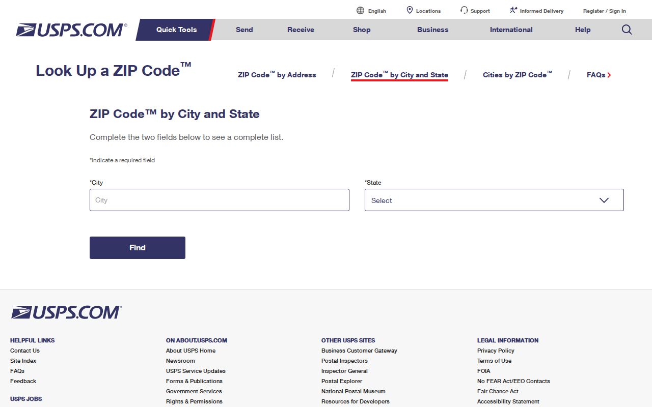
The USPS screen shows why a full delivery form matters. A building number without a unit can point to a different result than the completed address. Preserve the returned postal form separately from the address spelling in a historical source or from a tax mailing address. That separation is particularly important around Waco routes that use PO boxes, special service, or a postal city label broader than the city line.
| USPS field or mode | How it is used |
|---|---|
| Street Address | Required for the address lookup route. |
| City and State | Used with the address route; city and state can also be searched as a separate mode. |
| Apt/Suite | Available for a complete unit-level delivery check. |
| ZIP | Available in the city-and-state route and for ZIP-to-cities lookups. |
| Company | Available field, but a postal result does not verify a named recipient. |
Waco ZIP Tax Search
The McLennan County Tax Office account search does not advertise a ZIP filter. It is still useful after USPS and GIS establish the address form because it searches owner name, a property-address prefix, account number, CAD reference number, or fiduciary number. A second optional criterion can narrow a large result set. Use the tax account as a parcel and tax-status source, not as proof that a particular person receives mail at the situs address.
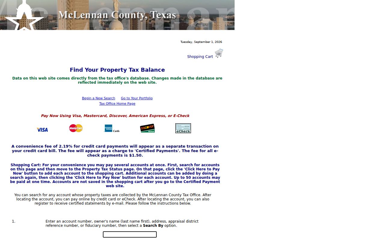
The tax search image shows the actual address-oriented choices. Enter an address only after its postal form has been checked. The two-field option can intersect an owner name with a property address, account, CAD reference, or fiduciary number. The result can show the account number, owner name, property address, CAD reference, tax status or balance, taxing unit, and statement controls.
| Tax Office search field | Search note |
|---|---|
| Owner Name | Enter last name first. |
| Property Address | Searches an address that starts with the entered text. |
| Account No. | Looks up the specific tax account. |
| CAD Reference No. | Uses the linked appraisal reference. |
| Fiduciary No. | Searches the fiduciary identifier when available. |
Find Residents Within Waco ZIP Codes
Searching within a postal area requires a narrow, repeatable sequence. USPS validates a delivery address. The City of Waco map service then compares the address point or parcel with the ZIP and city-limit layers. Tax and appraisal records provide parcel-linked information when the property address is known. Texas My Voter Portal requires a specific name, county, date of birth, and ZIP for an individual status check. It is not a map or a public ZIP-wide roster.
- Enter the full street address, city, and unit in USPS, then save the standardized delivery form.
- Open the Waco Information Services MapServer and compare its address or parcel layer with the ZIP and city-limit layers.
- Use the Tax Office or McLennan CAD with the confirmed address, property ID, geographic ID, or CAD reference to reach parcel-linked records.
- Use Texas My Voter Portal only for the named individual's permitted status lookup, with the required name, county, date of birth, and ZIP.
- When a ZIP result has narrowed the question to one street, use the Waco street directory for the address-by-address record path.
Each source answers a different question. A postal result checks delivery formatting. A GIS layer checks geography. A tax account connects an address to a parcel record. A voter lookup does not authorize a broad street or ZIP list, and protected residential addresses remain confidential under Texas Election Code section 13.004.
Waco ZIP Map Layers
The Waco GIS REST service is the practical local map authority for parcel, address, ZIP, neighborhood, city-limit, ETJ, council-district, school-district, and other layers. It supports identify, query, and export functions. Use it to compare shapes and parcel context, not to infer who lives at a location. Its ZIP layer can answer a geography question, while a parcel layer can show the property footprint and legal research path.
Keep four address fields where the sources differ: the situs address is the physical parcel location; the tax mailing address receives assessment or tax correspondence; the postal address is the USPS-standardized delivery form; and the source display address preserves the spelling in a historical or court record. Property ID, Geographic ID, CAD reference, account number, and abstract or survey references are safer keys than a street string when the record trail crosses map layers.
Note: Waco's GIS ZIP layer and parcel layer should be compared with the city-limit layer before calling an address municipal Waco.
Waco ZIP Code Boundary Gaps
A Waco mailing city can include an address outside the City of Waco, and a parcel inside a Waco-oriented search may use a postal designation that does not mirror city limits. That is the central local boundary caution. Postal delivery, municipal jurisdiction, neighborhood identity, and legal parcel description use different systems. Do not assign a neighborhood from a ZIP alone, and do not mistake a PO box, an institutional ZIP, or a tax mailing address for the physical site of a parcel.
- ZIP code
- A USPS delivery-routing number. It is not a city-limit, county, or parcel boundary.
- ZIP+4
- An added four-digit delivery detail used with the basic ZIP. It improves mailing precision but does not establish a municipal boundary.
- PO-box ZIP
- A postal number associated with post-office box or special service. It may be a valid delivery destination without identifying a physical residence.
- Unique ZIP
- A number used for a special or institutional postal purpose. The reviewed sources require a live USPS check before a local boundary or retail-office label is stated.
- Carrier route
- A postal delivery grouping. It is not a neighborhood map or an ownership record.
Waco ZIP Code Research Fields
A ZIP code directory works best when each result keeps its source field. Record the address as found, normalized street, unit, city label, ZIP, ZIP source, situs-or-mailing status, parcel or CAD ID, instrument or case number when present, observed date, custodian, and a short confidence note. The confidence note should describe how well a record answers the stated question, not guess where someone lives now.
This record discipline prevents a tax mailing ZIP from becoming a parcel ZIP, or a historic spelling from replacing a USPS-standardized form. It also makes a later correction straightforward. Compare the source-display address with the cadastral parcel key before connecting a historical directory, deed, tax account, or court filing to a current Waco postal result.
Waco ZIP Codes Needing Verification
Some Waco numbers need a date-stamped live check before they can be given a more precise label. The research did not capture a current retail station description for 76795, 76797, 76798, or 76799. The available USPS document says the Waco Sectional Center Facility serves some processing volume, which is not the same thing as a customer-facing postal assignment. Leave those numbers as special, unique, or institutional leads until USPS confirms the exact street or service question.
The reviewed records also did not establish whether a live McLennan CAD parcel card separates postal ZIP, mailing city, and situs ZIP fields. CAD's advanced search shows neighborhood and tax-year concepts, but not an independently captured address-to-ZIP result field. Preserve the source and date for every lookup, then return to USPS and GIS when the address form, city label, or parcel geometry conflicts.
When a new construction or subdivision address is missing, Waco Development Services or Planning is the local human route for a planning or plat question. The published Citizen Self Service portal and the Development Services counter are the documented online and in-person routes. The reviewed sources did not identify a separate public E911 readdressing database, a citywide renumbering project, or an annexation-to-address conversion table. Keep that gap visible rather than guessing how an older street string maps to a current postal address.